Natura Styriaca
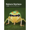
Natura Styriaca ist eine Zeitschrift mit naturwissenschaftlichen Fachbeiträgen, insbesondere die Steiermark betreffend.
Natura Styriaca ist eine Zeitschrift mit naturwissenschaftlichen Fachbeiträgen, insbesondere die Steiermark betreffend.
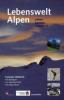
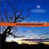
Für alle, die in den Alpen unterwegs sind: Allgemein verständlich und doch wissenschaftlich korrekt vermittelt Lebenswelt Alpen Naturphänomene und Zusammenhänge, denen man in den Bergen auf Schritt und Tritt begegnet:


For the first time a comprehensive overview of geo-conservation in Europe has been presented in a book. Geoheritage in Europe and its Conservation includes specific contributions from 37 countries focussing on legislation and geoconservation practices. The only record of the history of our planet lies in the rocks beneath our feet: rocks and the landscape are the memory of the Earth.
Publicación científica semestral de la Fundación Miguel Lillo. Tiene como objetivo divulgar trabajos originales sobre ciencias geológicas y afines.
This book aims to give more specific and more easily accessible information about Dokdo's ecological, geological, and meteorological conditions, and marine ecosystem. By examining this unique volcanic island, which has a specific endemic ecosystem, it is anticipated that the information might foster a better understanding of Dokdo.